
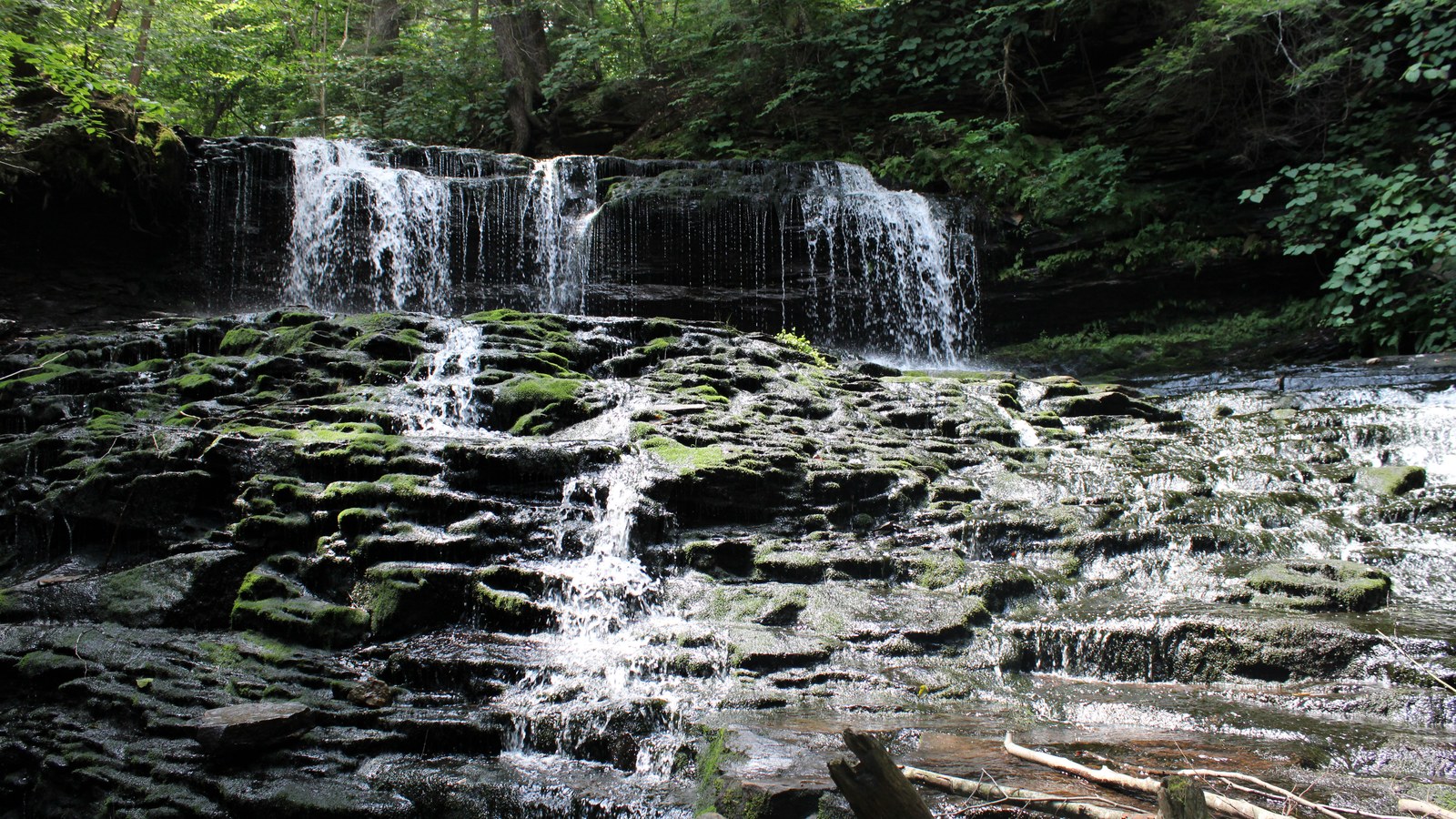
Ricketts Glen State Park’s Falls Trail is a steep, rocky waterfall route in northeastern Pennsylvania, operated by the Pennsylvania Department of Conservation and Natural Resources. The full loop is about 7.2 miles and passes 21 named waterfalls, including 94-foot Ganoga Falls, but it is rated most difficult for good reason: wet stone, sustained climbing, changing weather, and winter closures demand more than casual footwear and optimism. Visit for one of Pennsylvania’s richest concentrations of cascades, then choose the full loop or the shorter 3.2-mile option according to daylight, trail conditions, and the slowest person in your group.
Falls Trail quick facts
- Operator
- Pennsylvania Department of Conservation and Natural Resources
- Full loop
- Approximately 7.2 miles; rated most difficult
- Short option
- Approximately 3.2 miles using the Highland Trail connection
- Waterfalls
- 21 named falls along Kitchen Creek
- Primary hazard
- Wet, uneven rock beside steep drops
- Winter
- Falls Trail closes to ordinary hiking; specialized equipment and experience are required where permitted
Which Falls Trail route fits your day?
The full loop links the Glen Leigh and Ganoga Glen sides of Kitchen Creek. It is the complete experience, but the distance understates the effort because the route repeatedly climbs stone steps and rough tread beside waterfalls. The shorter loop uses the Highland Trail to connect the glens and keeps several major cascades in the day while cutting mileage. Read the current DCNR hiking description and carry the official map rather than relying on a screenshot from a third-party route.
Terrain, pacing, and safety
Footing is the central limitation. Spray, rain, leaf litter, and ice can turn the stonework slick. Wear footwear with reliable traction, keep hands free, and give uphill hikers room on narrow sections. Do not climb on waterfall ledges or leave the marked trail for a cleaner composition. Pack water and a layer even on a warm valley day; the gorge can feel cooler and darker, while exposed climbs still build heat.
Winter is a separate activity, not a tougher version of the summer hike. DCNR closes the Falls Trail to ordinary hiking when icy conditions arrive and restricts use to people with the required equipment and experience. If the route is closed or conditions exceed the group, use another park trail or switch to a lower-risk stop such as Hawk Falls at Hickory Run State Park.
How to photograph the glens
Overcast light reduces contrast between white water and dark forest. A phone’s standard lens is often enough for environmental views; a modest wide-angle lens helps in tight sections, while a short telephoto can isolate steps in a cascade without moving off trail. A polarizing filter can control glare on wet leaves and rock. Tripods must never block the path, and long exposures should wait until traffic is light enough to work without creating a hazard.
Parking, facilities, and timing
Confirm the trailhead, road, and park alerts on the official Ricketts Glen State Park page. Start early enough to avoid finishing in gorge darkness, and turn around when time, weather, or footing changes. Stay on the trail, pack out every item, and protect vegetation along the narrow corridor. For a very different western Pennsylvania structure-and-landscape session, compare the approach with the Kinzua Bridge photography guide.
What should you know about parking and facilities?
The Falls Trail listing identifies modern restrooms, picnic tables, and benches as trailhead amenities. Use the current DCNR park map to choose the correct parking area for the loop you intend to hike, and do not create a roadside space when an official lot is full. Pennsylvania state parks do not charge a general entrance fee, although camping, reservations, and some facilities can carry separate charges. Busy waterfall weekends reward an early start because a full parking area can turn a carefully paced hike into a late departure.
The Falls Trail itself should not be described as an accessible route: DCNR rates it most difficult and documents steep, rocky, slippery terrain. Visitors looking for accessible recreation or an easier forest walk should use the park’s accessibility information and trail list to choose a different experience. The one-mile Evergreen Trail, for example, reaches Adams Falls from its own parking area and is rated easiest, though individual access needs still require a current check with the park.
Should you bring a dog on the Falls Trail?
Pennsylvania state parks permit pets in day-use areas and other places not specifically closed, but animals must remain physically controlled and attended. That statewide permission does not make the Falls Trail a comfortable dog walk. Narrow stone steps, passing traffic, wet rock, and sustained climbing can be hard on an animal and everyone sharing the route. Check the current DCNR pet rules, carry water, pack out waste, and choose a less technical park trail when the dog’s footing or crowd tolerance is uncertain.
What changes after heavy rain or during peak color?
Higher flow can make the waterfalls more energetic while increasing spray and reducing traction. Autumn color adds visual depth but also brings leaf cover to uneven stone and concentrates visitors on already narrow tread. Treat the forecast, recent rain, daylight, and crowd level as one decision—not four separate checks. When those factors stack against the group, shorten the loop or save the glens for another day.
Official sources and updates
- Pennsylvania DCNR: Ricketts Glen hiking and Falls Trail details
- Pennsylvania DCNR: Ricketts Glen State Park visitor information
- Pennsylvania DCNR: Ricketts Glen accessibility
- Pennsylvania DCNR: pets in state parks
Planning context: Compare this destination-scale hike with the statewide Pennsylvania Waterfalls Guide, or return to Start Here to choose by effort, trip type, available time, and season.
Carry the regional thread: browse PA Falls Here gear after the route is planned.